
About Charan Paduka Badrinath
Charan Paduka is a sacred rock with a footprint of Lord Vishnu, situated on Nar Narayan Parvat at an altitude of 3,380 meters (11,089 feet) near Badrinath in the Chamoli district of Uttarakhand, often known as Vishnu Charan Paduka.
Located 3 km from the Badrinath Temple, followed by a short trek on a rock formation path. Charan Paduka is not just a sacred rock but also holds great spiritual significance. The beautiful Himalayan surroundings eventually made it a significant site.
This sacred rock attracts many pilgrims to seek blessings and devotion, as the Badrinath Yatra is incomplete without a darshan of this holy rock.
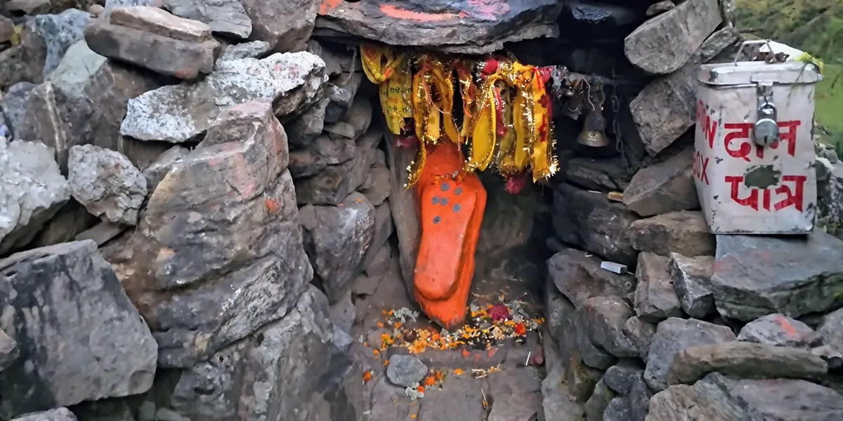
Table of Contents
Where is Charan Paduka?
Charan Paduka is located in the Chamoli district of Uttarakhand near the Badrinath Temple. Situated on Narayan Parvat at an altitude of 3,380 meters (11,089 feet) above sea level.
What is the altitude of Charan Paduka?
Quick Facts
- Location: Narayan Parvat (Chamoli district, Uttarakhand), about 3 km from the Badrinath Temple
- Height/Altitude: 11,089 feet (3,380 meters)
- Trek distance: 3 km from Badrinath
- Trek duration: 1 to 1.5 hours one way
- Trek difficulty: Moderate (Steep ascents)
- Best time to visit: May to October
- Winter status: Inaccessible due to snowfall (November to April)
- Mythological significance: Associated with Lord Vishnus' footprints. It is believed to bear the footprints of Lord Vishnu, while his decent to earth from Vaikunth.
- Highlights: Views of the surrounding scenery
- Visible peaks: Neelkanth, Nar Narayan, and Balakun
What Is The Story Of Charan Paduka Badrinath?
Charan Paduka Badrinath is not just a rock but holds great spiritual significance in Hinduism; It is believed to bear the footprints of Lord Vishnu, where he placed his first foot while descending to earth from his celestial abode, Vaikunth, making it a sacred site for pilgrims who visit Badrinath Dham. It is believed that a view (darshan) of this sacred rock absolves the sins of pilgrims and blesses them for well-being.
Mythological Significance of Charan Paduka Badrinath
Footprints of Lord Vishnu: According to Hindu mythology, it is believed that Charan Paduka is the spot where lord Vishnu placed his first step while descending to earth from Vaikunth Dham, symbolising his divine presence and making it a sacred site for Vaishnavites (devotees of lord vishnu).
Narrative mythology: According to the legend of the Bhagavat Purana, the lord krishna told his minister, Uddhava, to visit Badrinath to cleanse the sins of his wrongdoings. Uddhava carried Lord Vishnu charan paduka with him, and it is said to have been his footprint on the charan paduka.
What is the Geographical significance?
How To Reach Badrinath Charan Paduka
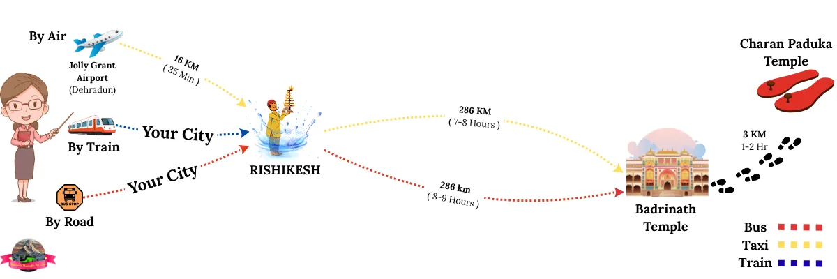
Charan Paduka is accessible by a 3 km trek from the Badrinath Temple. Here is a short overview of how to reach Charan Paduka from Haridwar, Rishikesh, and Dehradun.
-
Nearest Railhead: Haridwar and Rishikesh are the nearest railway stations to Charan Paduka. From there, take a taxi or bus to Badrianath and then head to Charan Paduka.
-
Nearest Airport: The Jolly Grant airport is the nearest airport to Badrinath and Charan Paduka. From there, hire a taxi or take a bus to reach Badrianath and embark on a trek to reach Charan Paduka.
-
Nearest Roadhead: Badrinath town is the nearest roadhead to Charan Paduka, which is easily accessible via Joshimath.
-
Badrinath to Charan Paduka : After reaching Badrinath, your final leg is a 3 km trek from the main temple to Charan Paduka.
Badrinath To Charan Paduka Distance
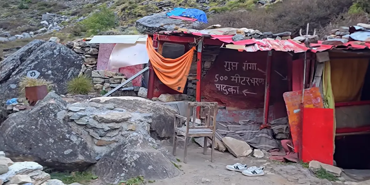
The distance from Badrinath to Charan paduka is 3 km one-way on a stony path, which takes almost 1-2 hours to complete. It starts from the left side of the temple and is filled with stunning natural beauty, including panoramic views of Neelkanth and Nar Parvat. Along the way, you also witness the Rishi Ganga River flowing.
Badrinath to Charan Paduka Trek details include:
Trek Distance: The distance from Badrinath to Charan Paduka is 3 km one-way.
Duration: 1-2 hours
Starting point: from the left side of the Badrinath temple
Route: passes through the lush valleys and majestic peaks
Difficulty level: strenuous and difficult due to the uphill path
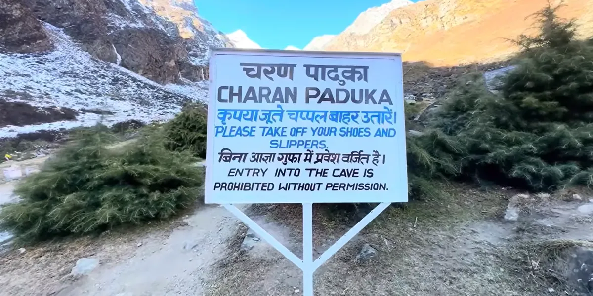
What to expect: After the uphill trek, you will witness a sacred rock of lord vishnu Charan. You may also see several boulder caves with sadhus.
Best Time To Visit Charan Paduka Badrinath
The best time to visit Charan Paduak coincides with the best time to visit Badrinath. When the Badrinath Temple is open, from May to October, it is considered the ideal time to visit Charan Paduka, as pilgrims plan their visit to Badrinath, along with Charan Paduka. Here is a short overview of ideal months and avoidable months for Charan Paduka.
-
Ideal months: May to June in summer and September-October in autumn are ideal months to visit Charan Paduka, when the Badrinath Temple is open, and this period offers pleasant weather and comfortable temperature, making it a perfect time for pilgrimage and sightseeing.
-
Avoidable months: Avoid monsoon, from July to August, as it experiences moderately heavy rain, which causes landslides, making trails slippery and travel risky at this time.

Places To Visit Near Charan Paduka
Badrinath Temple
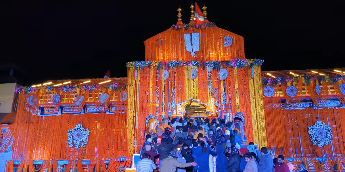
- Location: Garhwal Himalayans in the Chamoli district of Uttarakhand
- Altitude/Height: 3,133 meters (10,279 feet) above sea level
- Highlights: Tapt Kund, Nar Narayan Peaks, and Local Market
- Accessibility: Easily accessible by road journey via Joshimath by bus, taxi, or cab.
Mana Village
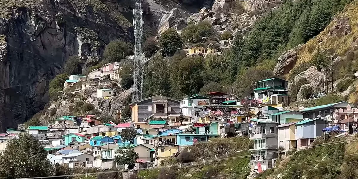
- Location: Chamoli district of Uttarakhand
- Altitude/Height: 3,200 meters (10,500 feet) above sea level
- Highlights: Bheem Pul, Saraswati River, and ancient caves (Vyas Gufa and Ganesh Gufa)
- Accessibility: 4.3 km road journey through shared jeep or taxi
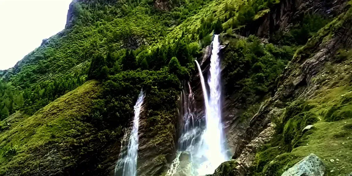
Vasudhara Falls
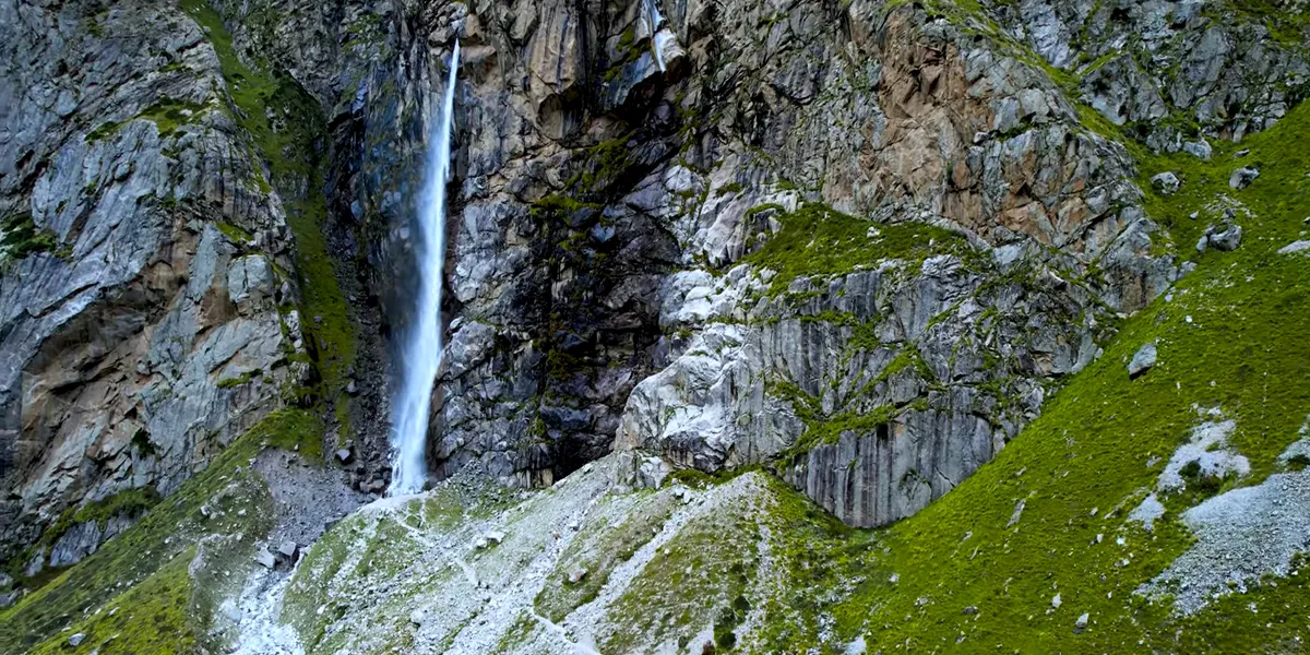
- Location: Alaknanda Valley near Badrinath in Uttarakhand
- Altitude/Height: 3,658 meters (12,000 feet)
- Highlights: Mana Village, Satopanth Lake, and Mata Murti Temple
- Accessibility: 6 km trek from Mana Village
Tapt Kund
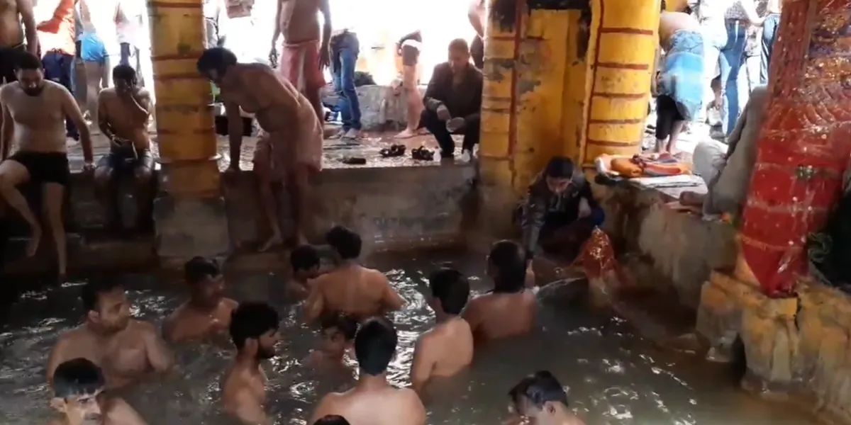
- Location: Near Badrinath, Chamoli district, Uttarakhand
- Altitude/Height: 3,658 meters (12,000 feet)
- Highlights: Badrinath Temple and Neelkanth Peak
- Accessibility: Short walk from the temple
Rishiganga Waterfall
- Location: Near Badrinath, along the route to Charan Paduka
- Altitude/Height: 4,250 meters (13,940 feet)
- Highlights: Badrinath and Mana Village
- Accessibility: Along the trekking trails that pass towards Charan Paduka
Safety Tips for Visitors
-
Pack warm layers & other essentials: Pack warm clothes and other trekking essentials, such as trekking shoes, rain gear, walking sticks, water bottles, a first-aid kit, etc., as the site is located in a remote area of the Uttarakhand Himalayas, which experiences a wider range of weather conditions.
-
Avoid trekking after sunset: Do not trek in the late evening, as it's not safe in the Himalayan regions.
-
Respect the serenity of the site: Do not make any noise, as the site also serves as a meditation spot for sadhus and saints, so be respectful in your behaviour.
-
Hire a local guide if needed: If you are a first-timer or beginner, hire a local guide who can guide you about the trails.
Conclusion
Charan Paduka is a sacred spot on the route to the Badrinath Temple, at the top of the Narayan Parvat Garhwal Himalayas of Uttarakhand. This site is renowned for its serene environment, picturesque beauty, and significance.FAQs Of Charan Paduka
The distance to Charan Paduka is approximately 3 km from the Badrinath temple. It is accessible by trek through rough and steep trails.
Why is Charan Paduka famous?
Charan Paduka is a famous site near Badrinath, as it bears the footprints of lord vishnu. It is believed that lord vishnu placed his step at this sacred place while descending to earth, making it a significant site for the pilgrims who were visiting Badrinath.
How long does it take to reach Charan Paduka from Badrinath?
The trek to Charan Paduka from Badrinath takes 1 to 2 hours from Badrinath. It can vary through the fitness level and pace.
Is the Charan Paduka trek difficult?
The trek to Charan Paduka is considered moderately challenging, as it is located at a very high altitude and it involves strenuous climbs.